Scarsdale, Westchester County, NY

Stop the Development of
0 Spier Road

A protected wetland lot, a living stream, and 13 mature trees — all threatened by one developer's profit-driven gamble.

Spier Road & Rock Creek Lane, Scarsdale, NY 10583

58 Years as Protected Wetland
13 Mature Trees to Be Removed
37.3 ft Proposed Peak Height
$1M+ Estimated Developer Profit
Sign the Petition — Protect Our Neighborhood

How a Wetland Became a Battleground

A developer who bought a Scarsdale property in 2022 is now attempting to squeeze a house onto a tiny, protected wetland lot — threatening a stream, a hillside ecosystem, and the character of an entire neighborhood.

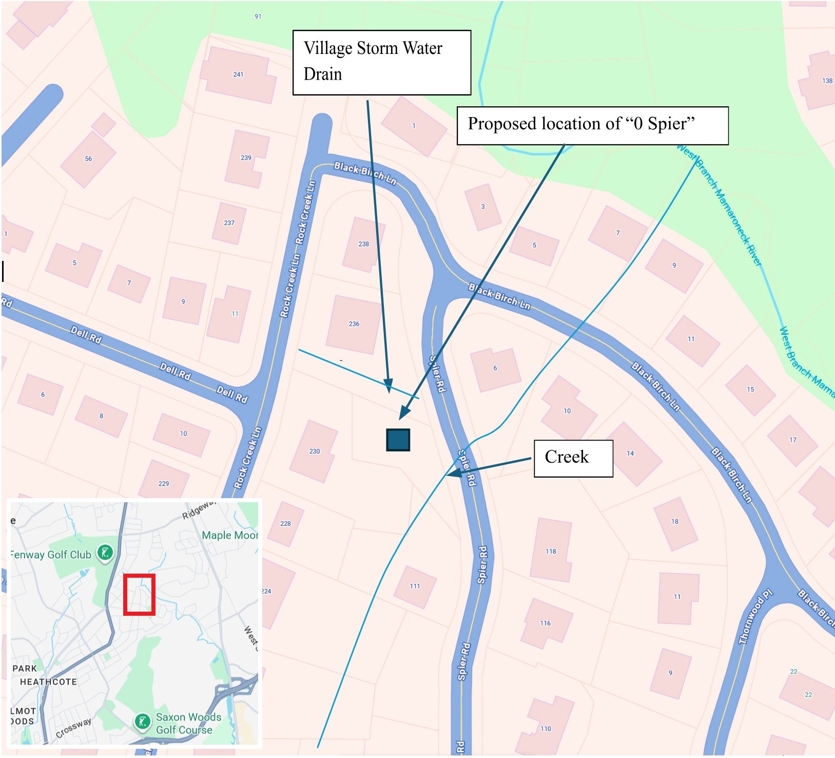
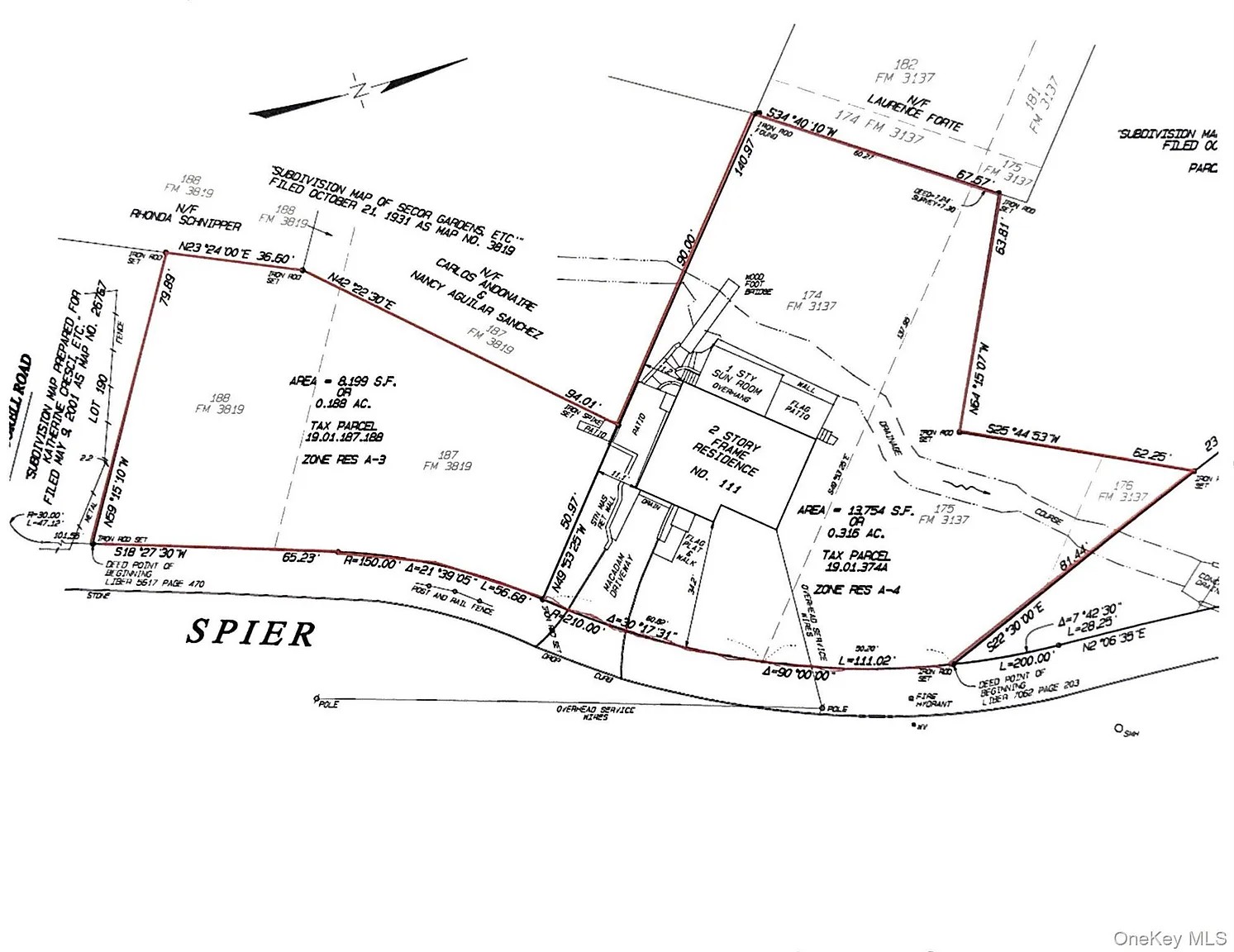
In January 2026, a developer submitted plans to the Village of Scarsdale's Planning Board to build a new single-family home on a small, irregularly shaped lot — tax parcel 19.01.375 — that had been part of 111 Spier Road for decades and sat undisturbed for over half a century. In that same January 2026 application, the developer coined the address "0 Spier Road" for the first time; the lot has no official street name of its own. What makes this remarkable is not just the audacity of the proposal, but the history of the land itself.

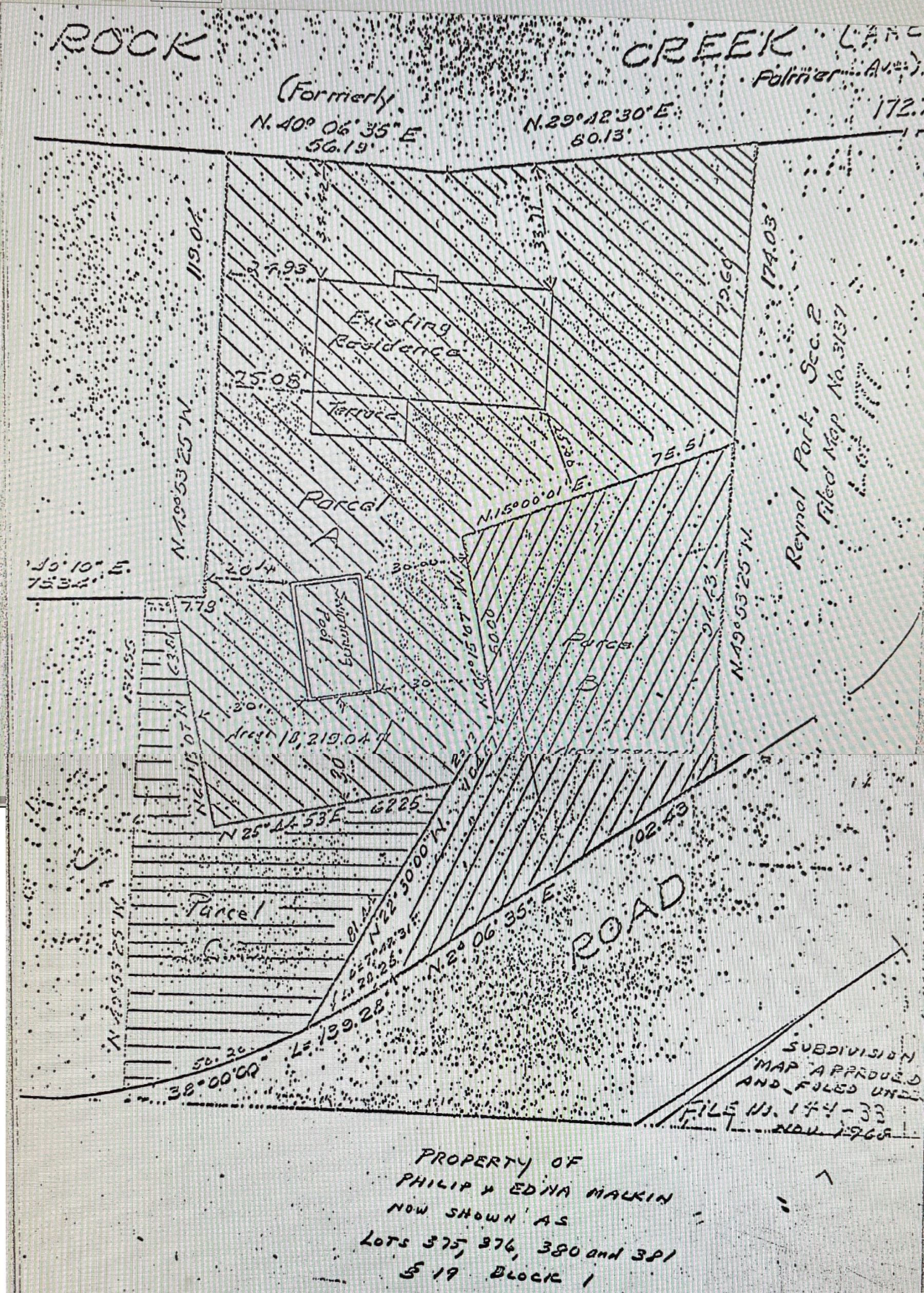
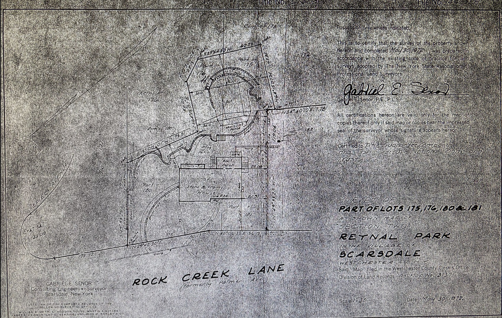
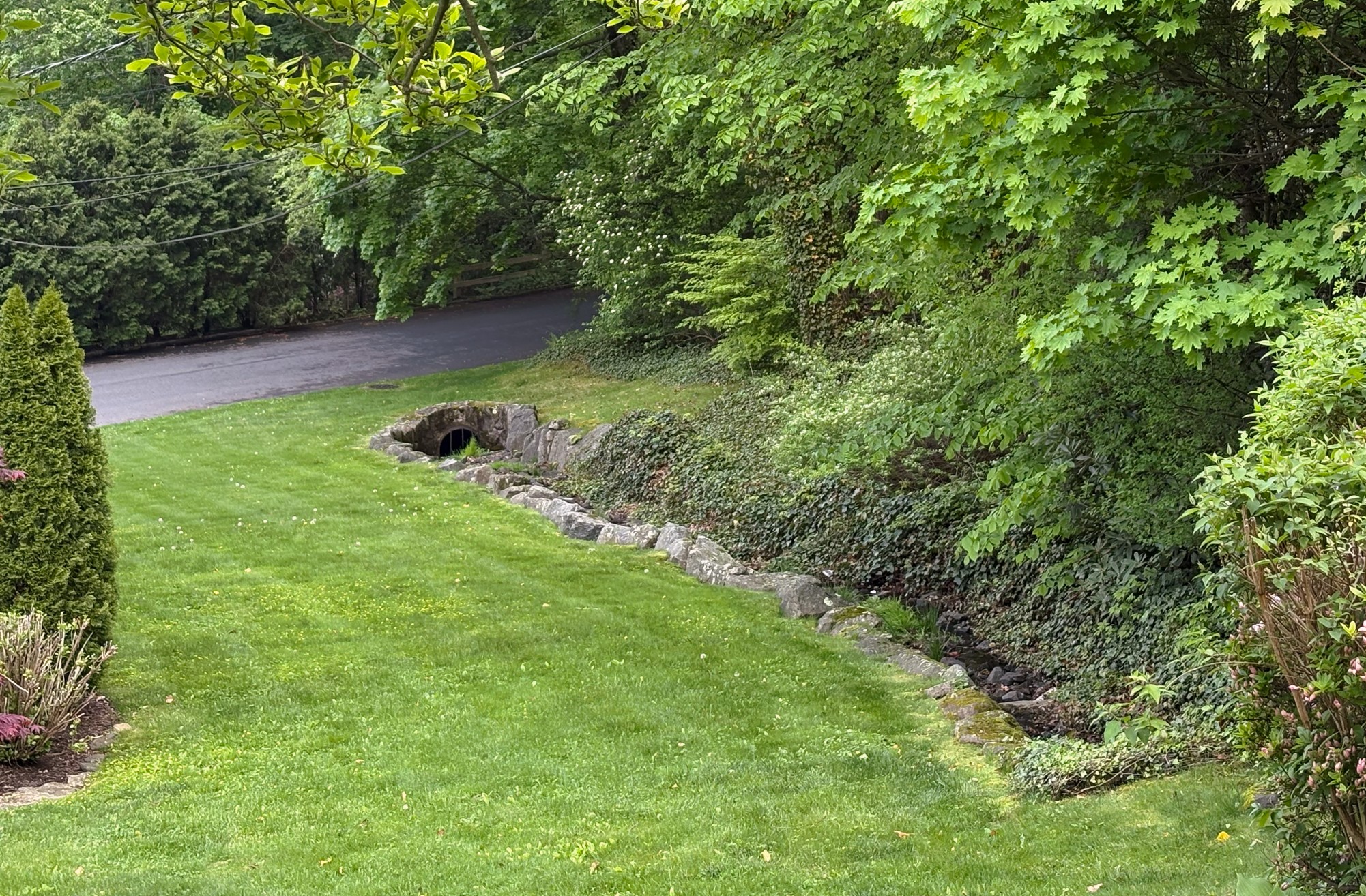
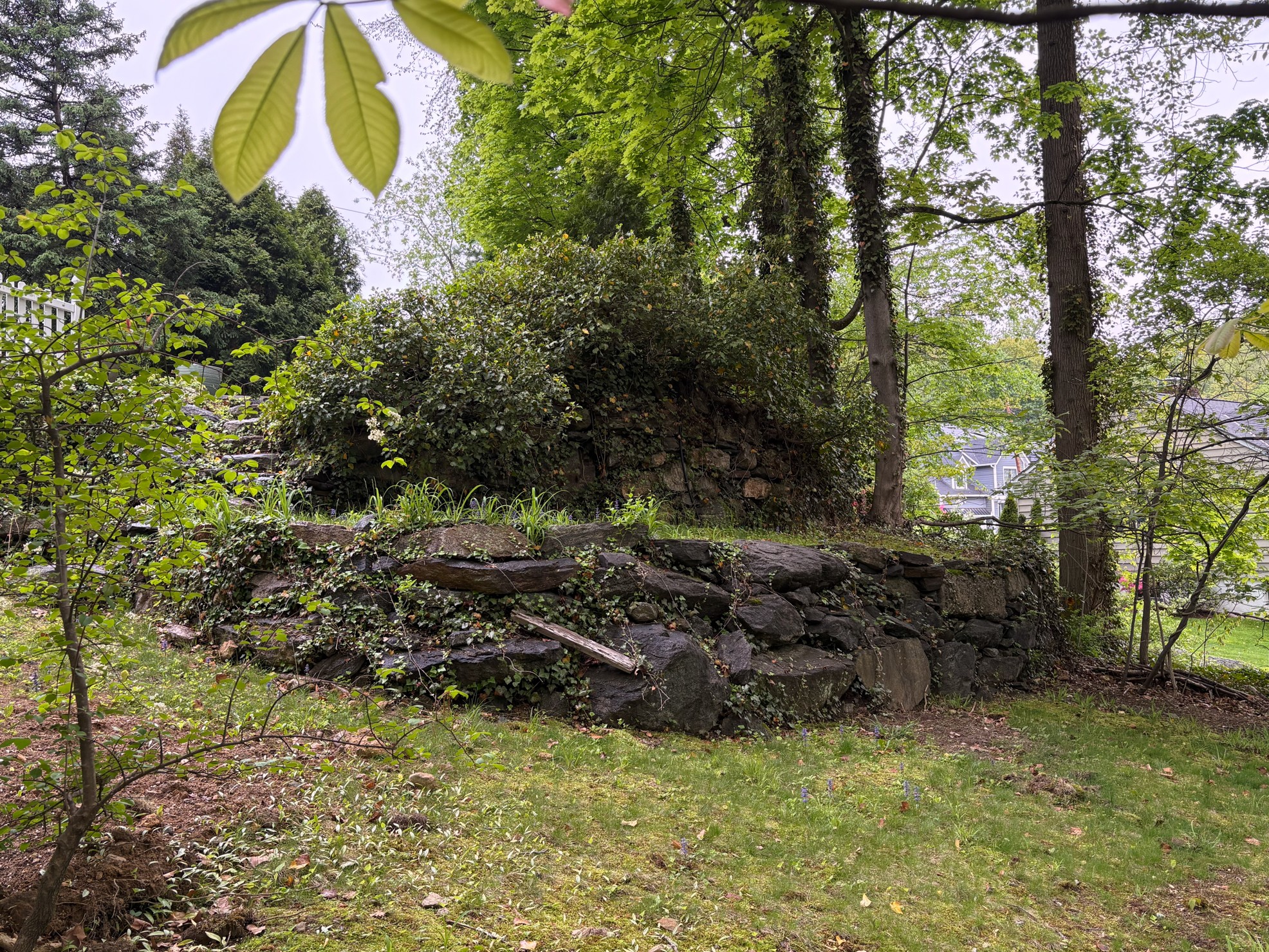
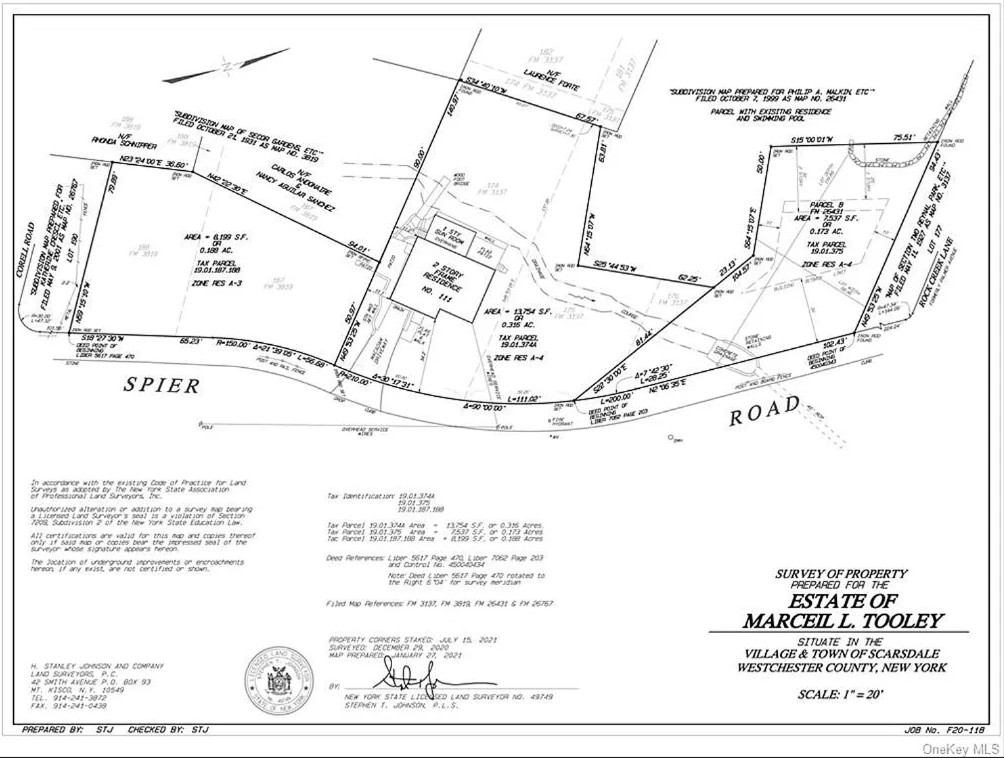
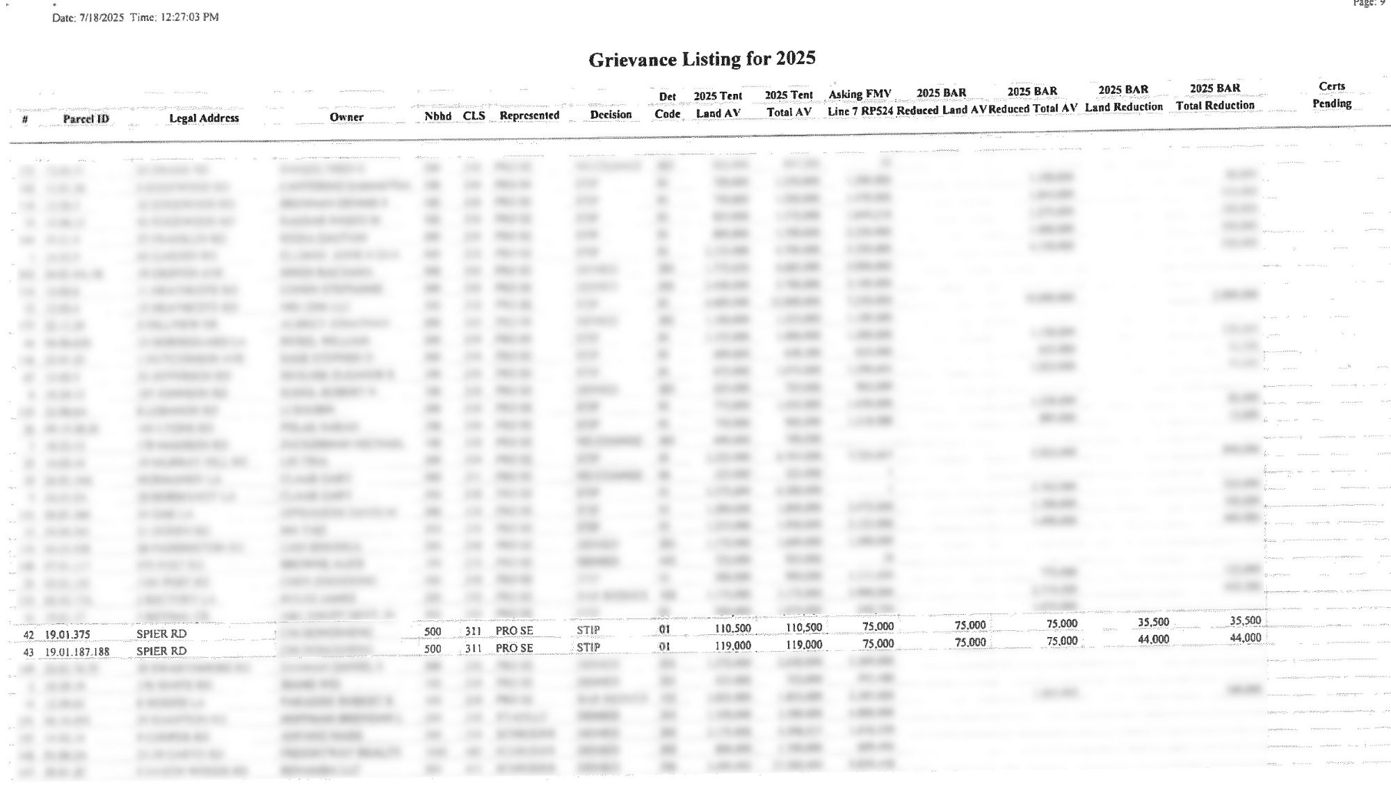
The lot — officially tax parcel 19.01.375 — was created in 1968 as a deliberate tax strategy, carved out of 230 Rock Creek Lane to take advantage of a lower wetland tax assessment. It is assessed at just $110,000; a comparable buildable lot nearby carries an assessment roughly seven times higher, at roughly $750,000. The difference is not arbitrary. It reflects a long-standing recognition by the Village of Scarsdale that this land is constrained by wetlands, a running watercourse, steep topography, and an open storm water drain running along its entire northern boundary. That drain and the creek carry significant volumes of water during heavy rains — and this neighborhood has seen plenty. The lot sits at the converge of two active water systems, making it not incidental open space but a critical buffer in the area's drainage network. Construction here does not merely affect a single parcel; it puts the entire surrounding drainage system at risk.

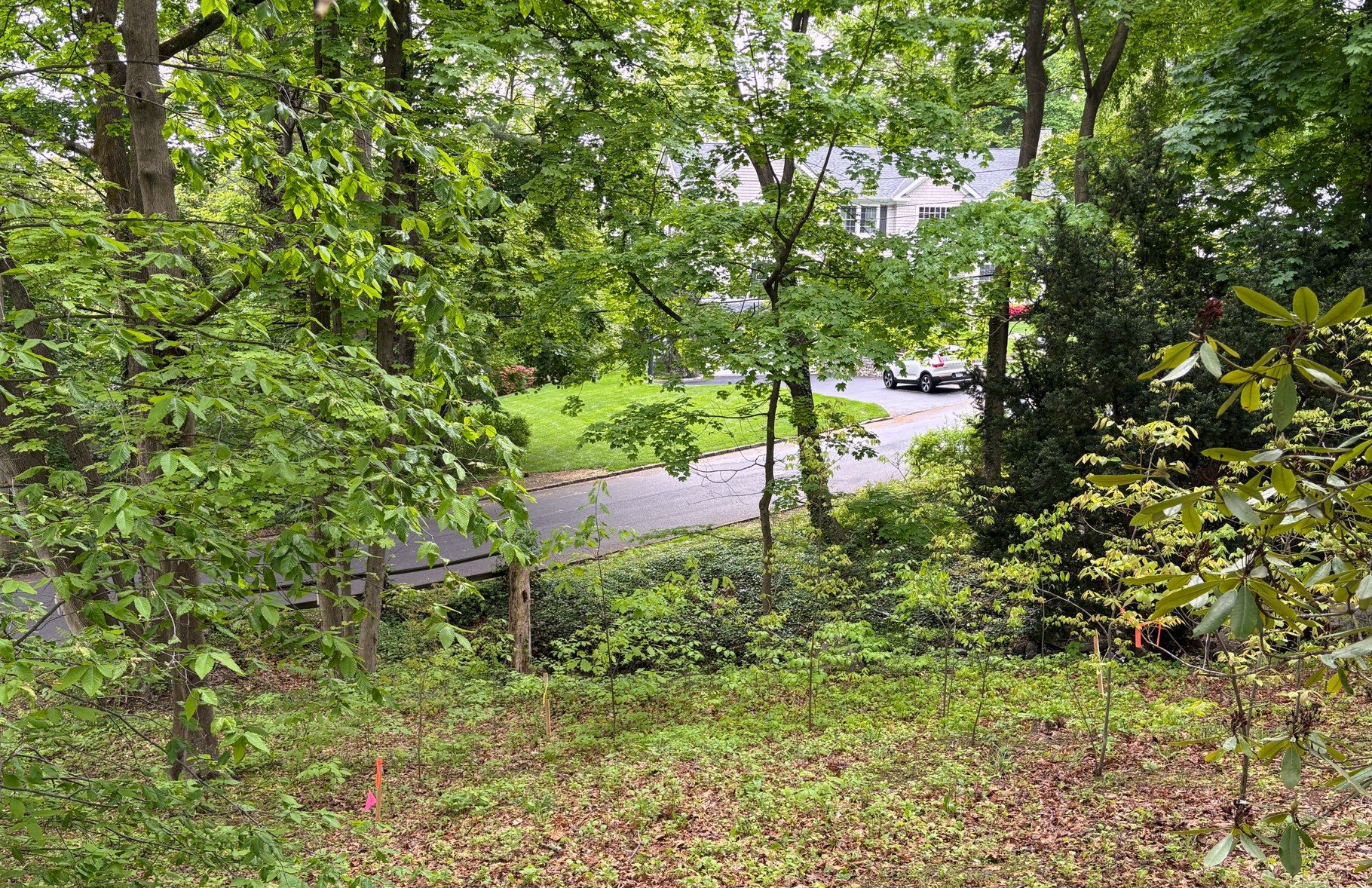
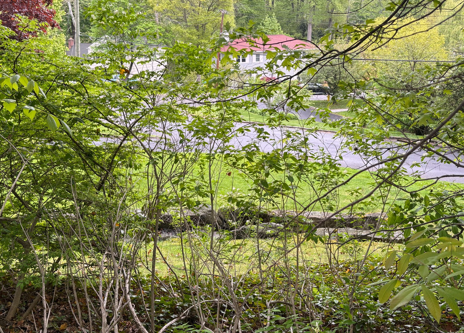
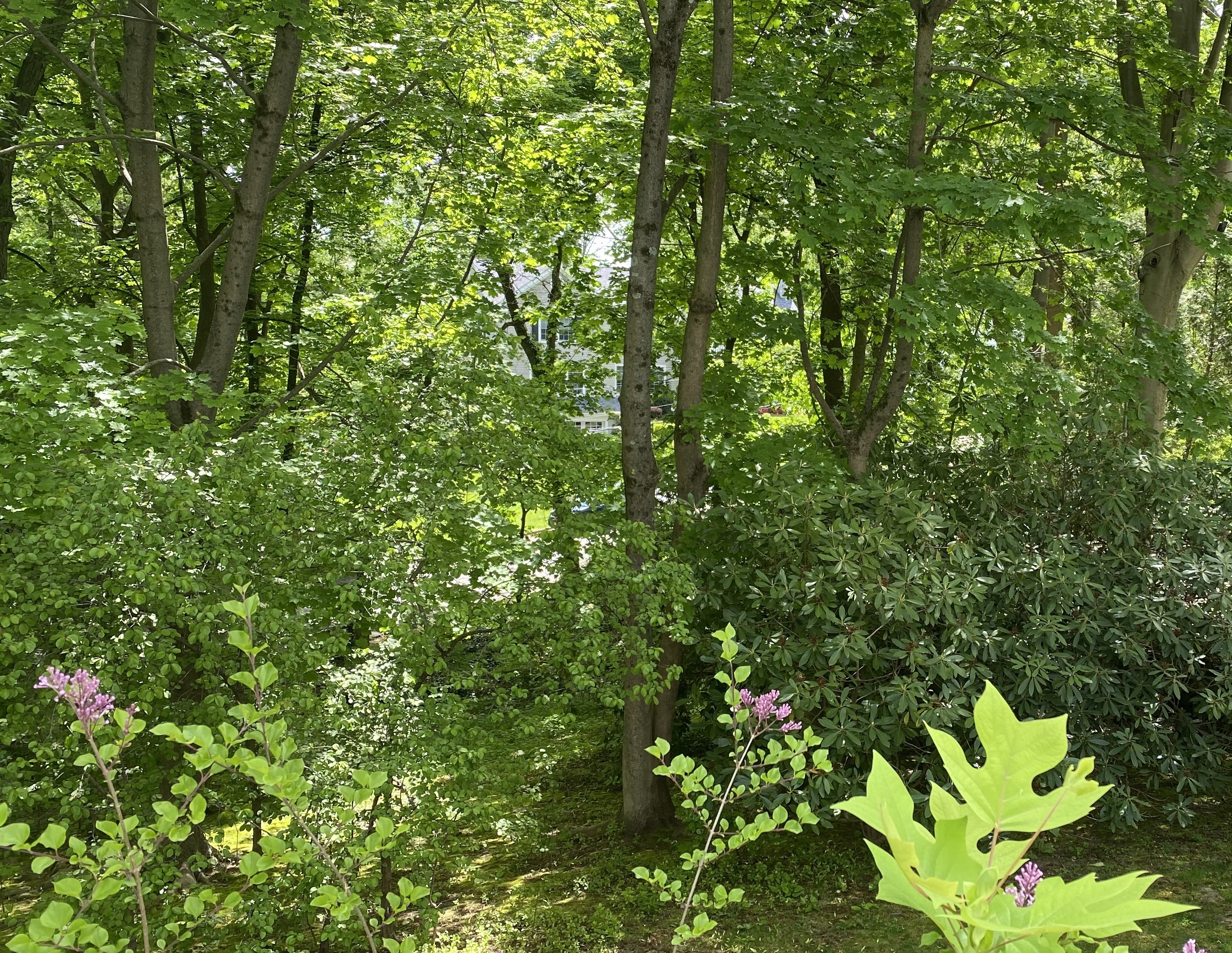
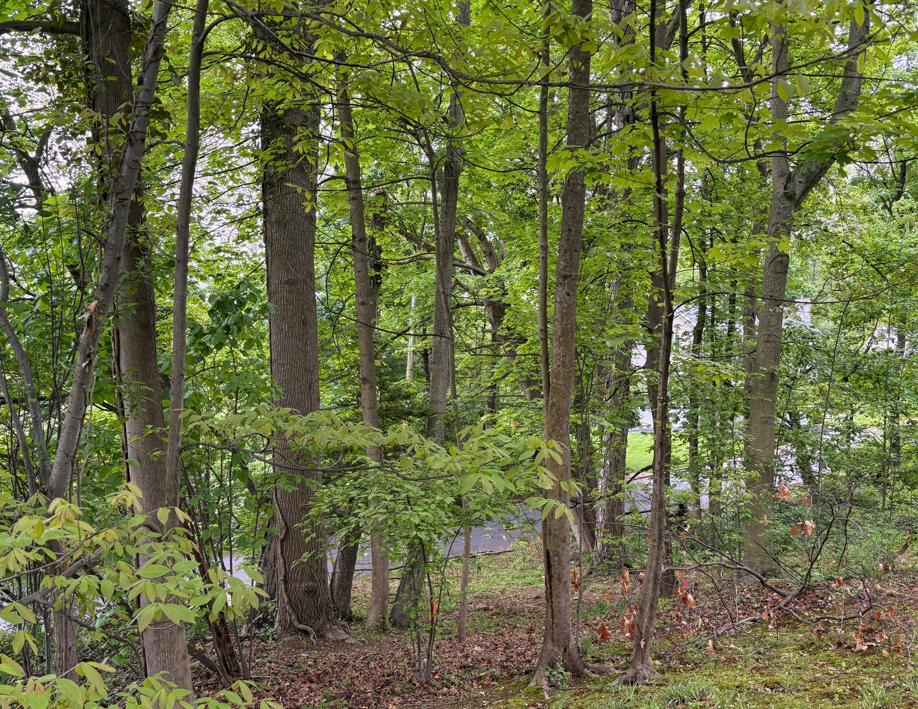
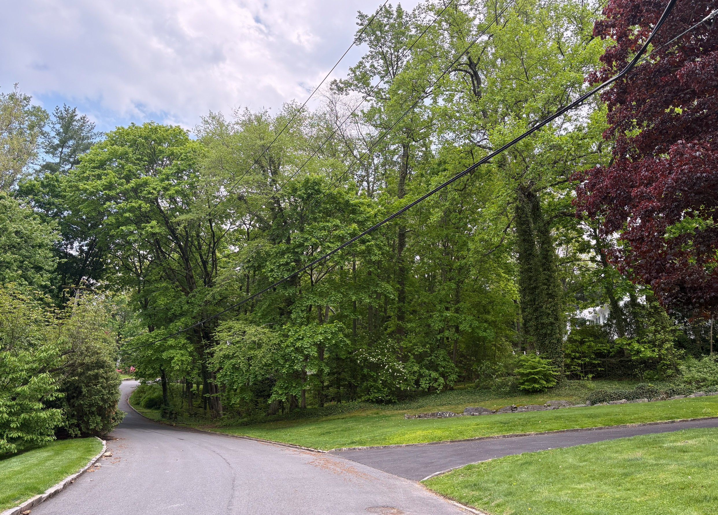
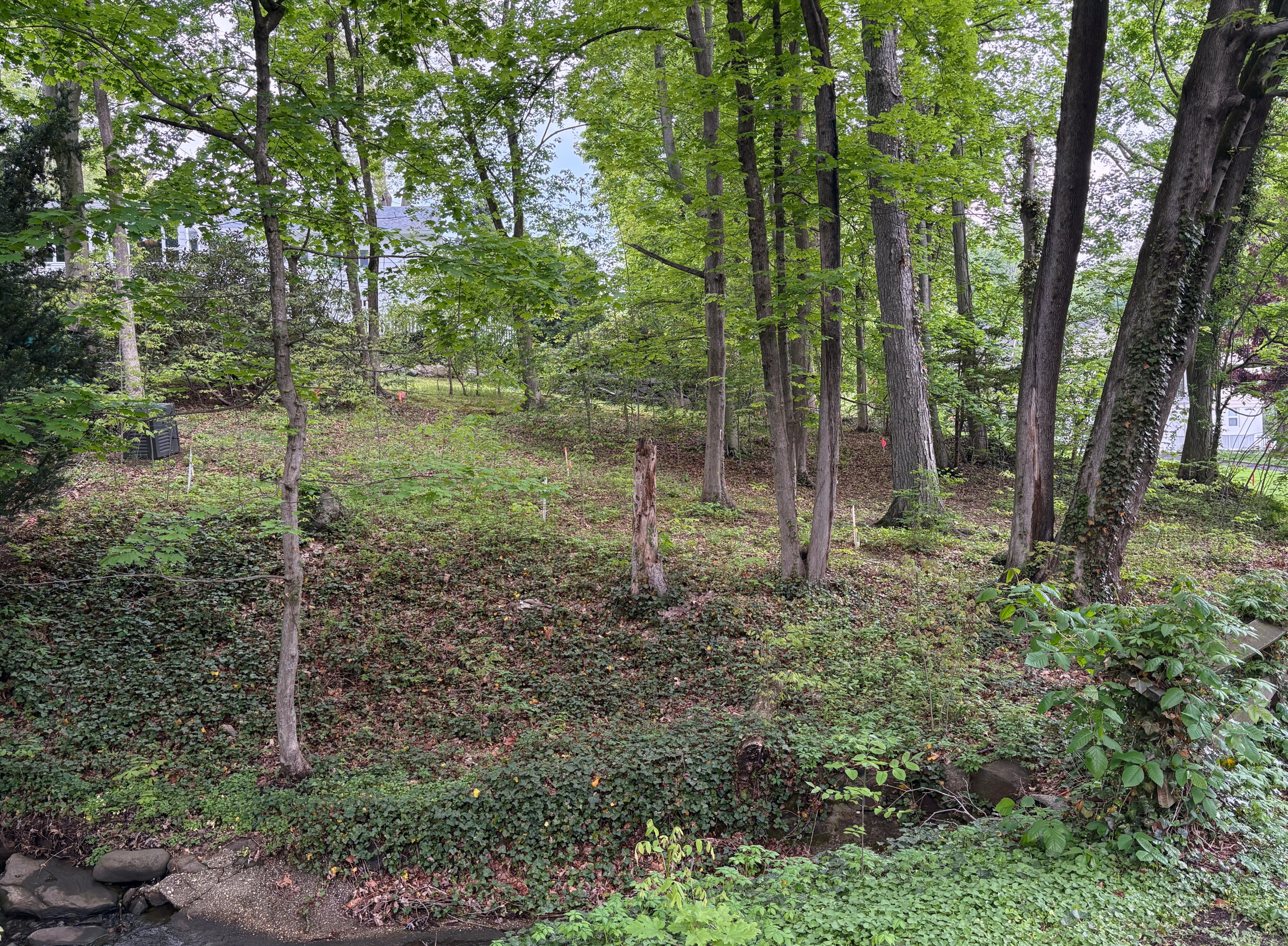
For decades, every owner honored that reality. No one built on it. The lot remained as nature shaped it — densely wooded, with mature trees and a living stream running through its length.

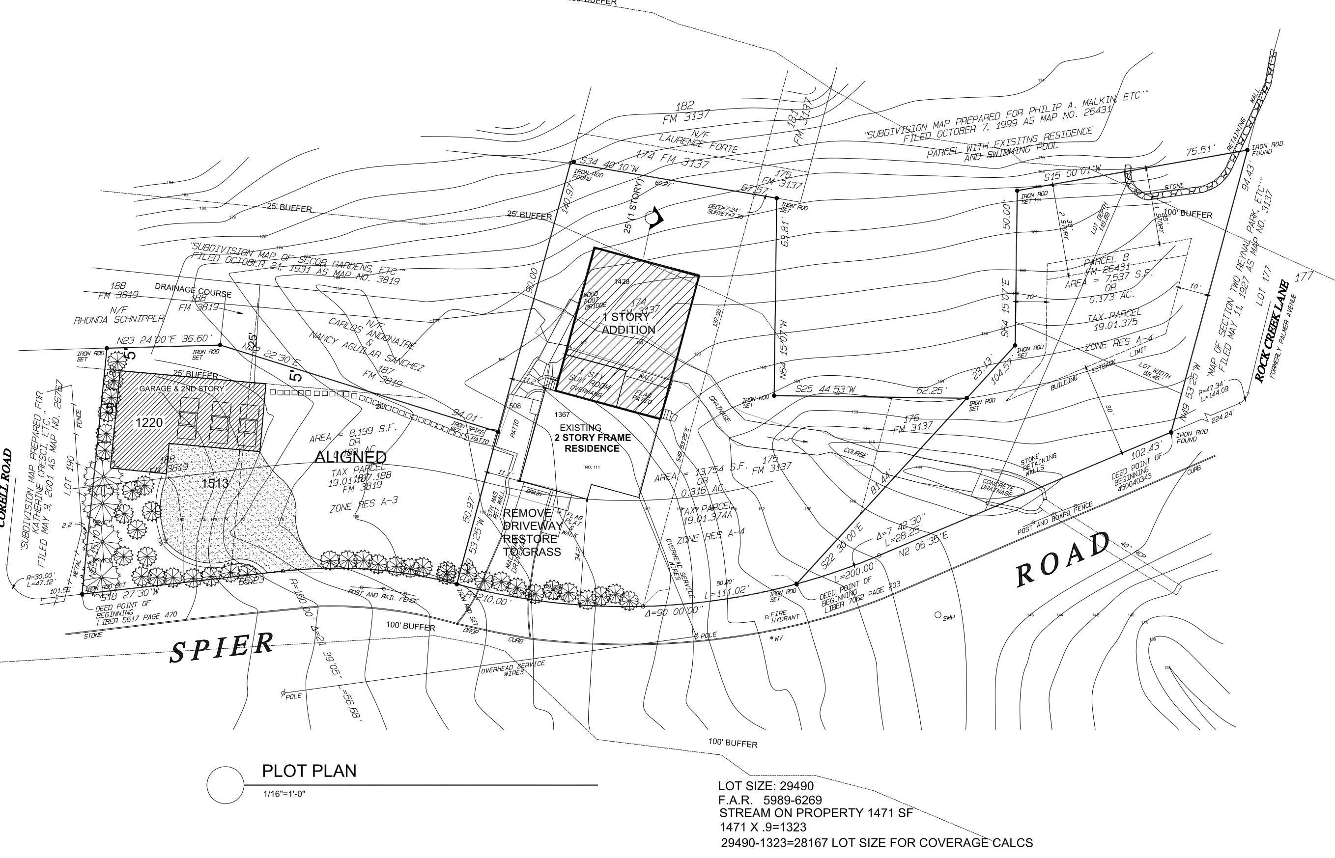
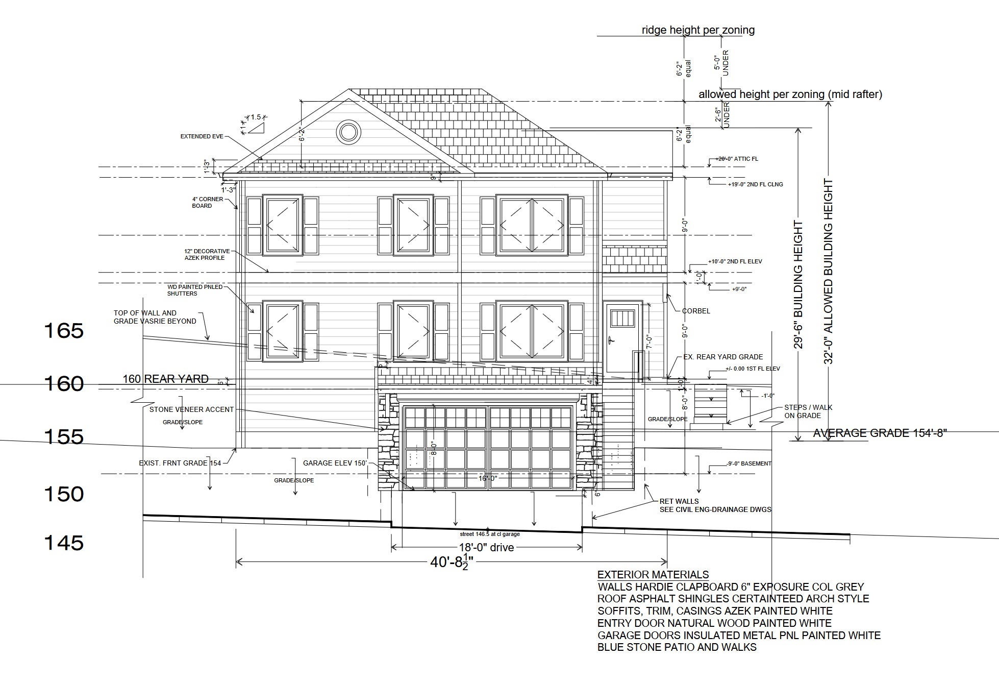
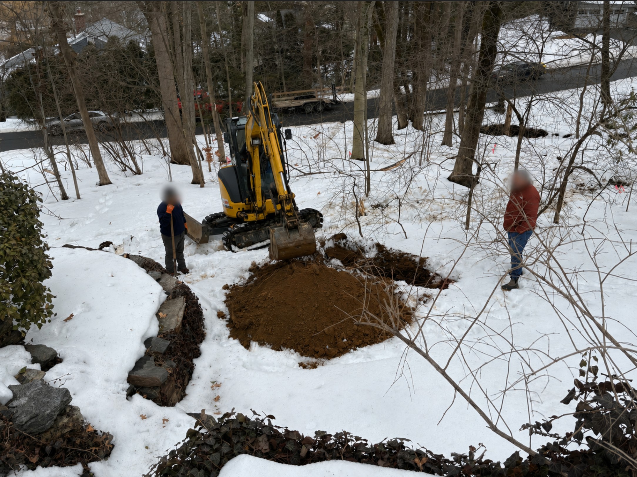
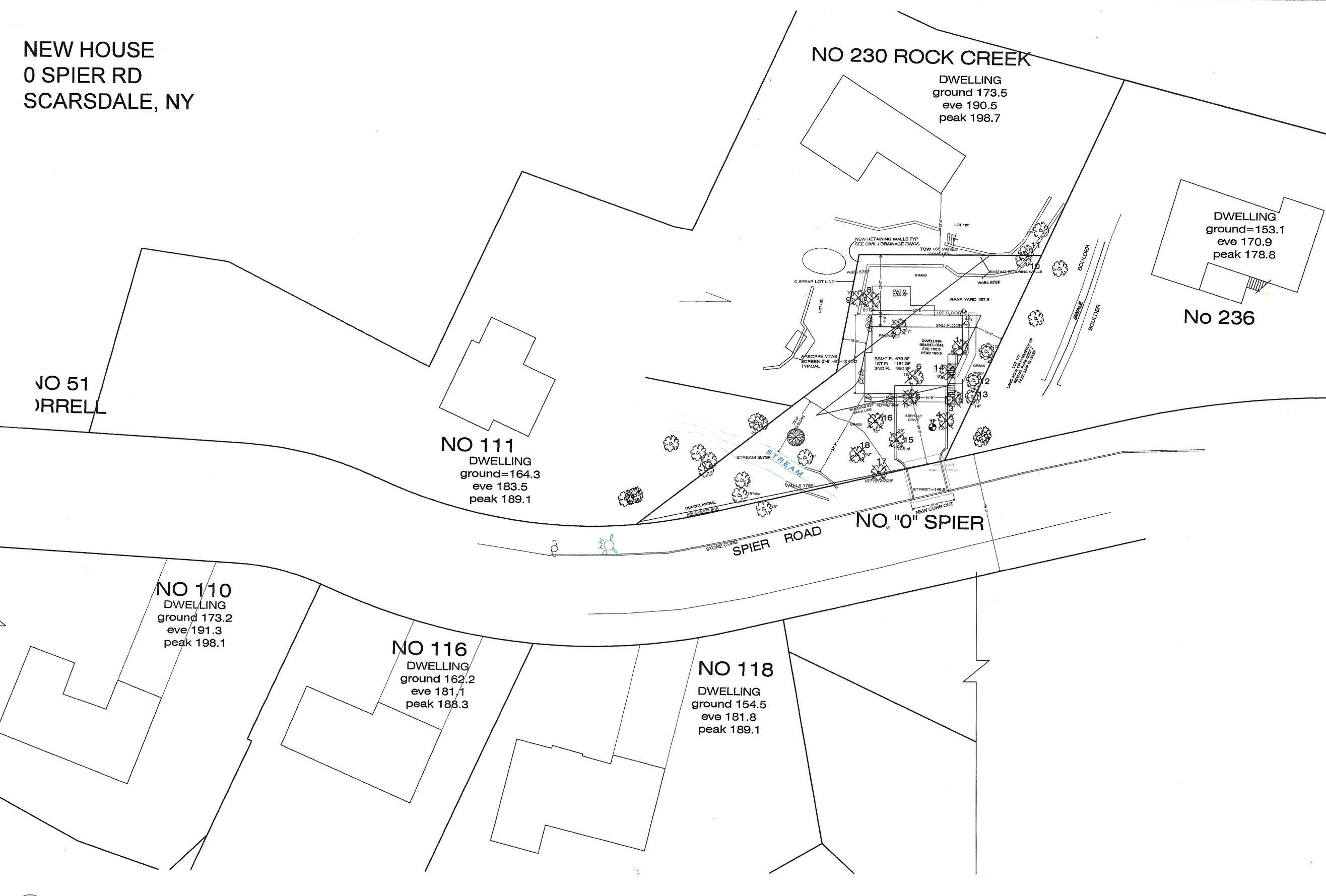
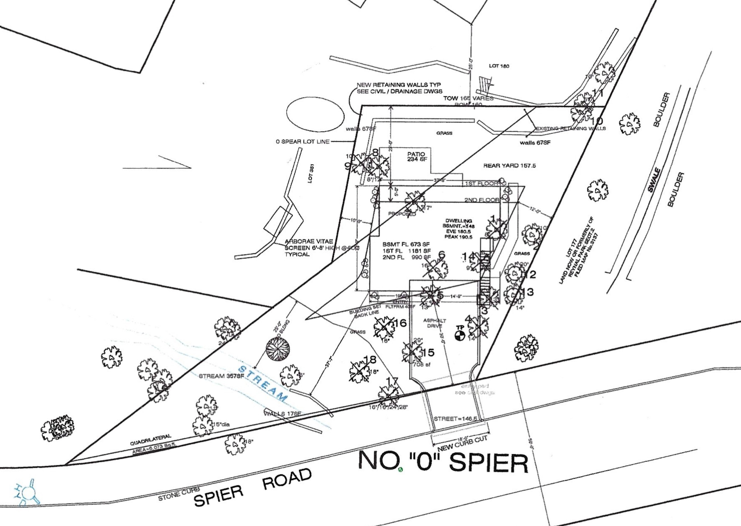
Then, in April 2022, a developer purchased 111 Spier Road — a package that included the 0 Spier parcel — for $887,250. Within months they attempted to flip the main house by enlarging it and adding a detached garage, but the developer was forced to withdraw the proposal after two Planning Board hearings, in the face of strong neighborhood opposition. The developer went quiet for several years, making incremental interior upgrades and renting out the property. Then, as Scarsdale's housing market heated up, they pivoted. In January 2026 they submitted plans to build a new house on the 0 Spier lot. By April 2026 they had listed the other two lots for $1,800,000 — having carved out the wetland parcel to develop independently. The strategy was clear: buy the whole, extract value from every piece, and squeeze a profit from land that every prior owner had left undisturbed.

Neighbors who live alongside this land — who have watched the stream run, the trees grow, and the hillside remain green for decades — are fighting back.

Aerial map showing 0 Spier Road and surrounding properties
Source: Google Maps — 0 Spier Road and surrounding parcels, Scarsdale NY
The watercourse running through 0 Spier lot, May 2026
The watercourse flowing through 0 Spier Rd — May 2026

The History of 0 Spier Road

Every owner of this land for over 50 years understood it should not be built upon. The current developer is the first to challenge that consensus.

1953

The Neighborhood Takes Shape

The existing homes along Spier Road and Rock Creek Lane are built during the early 1950s — modest, horizontally massed ranch-style houses integrated naturally into the hillside terrain. The area around what will become 0 Spier remains wooded and serves as a natural green buffer between properties.

1968

The Wetland Lot Is Created — For Tax Purposes

The owner of 230 Rock Creek Lane subdivides their property, creating tax parcel 19.01.375. The purpose is explicit: the new lot is designated as wetland, qualifying for a dramatically lower tax assessment. To meet the Village's minimum lot size of 7,500 square feet, the owner includes an existing retaining wall structure — physically part of 230 Rock Creek — within the new lot's boundaries. The village designates it as wetland and assesses it at a fraction of surrounding properties.

1968 subdivision drawing creating tax parcel 19.01.375

Source: Village of Scarsdale Archive

1972

Sold to the Neighbor — Maintained as Wetland

After 20 years, the owners of 230 Rock Creek Lane sell their property. Two parcels from the 1968 subdivision — including what becomes 0 Spier Road — are sold to the neighbor at 111 Spier Road. The main Rock Creek Lane parcel, including the house and swimming pool, is sold separately. The new 111 Spier owners keep 0 Spier wooded and undisturbed, continuing the established tradition.

1972 survey of 230 Rock Creek Lane showing the property split

Source: Village of Scarsdale Archive

2022 — January

Developer Acquires 111 Spier — Including 0 Spier Lot

A developer purchases the 111 Spier Road property for $887,250. The purchase includes all three lots: 19.01.375 (0 Spier), 19.01.374A, and 19.01.187.188. At this stage, the developer's own submitted plan to the Village leaves 0 Spier Road (the wetland lot) completely unchanged — acknowledging its constrained status.

2022 developer plan for 111 Spier showing 0 Spier lot unchanged

Source: Village of Scarsdale Planning Board

2026 — January

Developer Splits the Property and Files to Build on the Wetland

In a pivotal move, the developer relists 111 Spier on Zillow — but now as a reduced parcel. The sale listing covers only two of the original three lots, offered at $1,800,000. The 0 Spier wetland lot has been carved out and kept separately. Simultaneously, the developer files plans with the Village of Scarsdale to construct a new house on 0 Spier — a lot they and their predecessors had always treated as undevelopable. Despite having enjoyed the wetland's low tax assessment since 2022, the developer now aggressively pushes the Village to reclassify it as non-wetland to enable construction.

January 2026 Zillow listing of 111 Spier after subdivision

Source: Zillow Property Listing

2026 — Ongoing

Neighbors Fight Back

Residents surrounding 0 Spier Road — representing decades of neighborhood history — appear before the Village of Scarsdale Planning Board to oppose the project. Their opposition is unanimous and detailed: environmental harm, terrain incompatibility, neighborhood character violations, and the fundamental wrongness of building on a lot the Village has protected as wetland for 58 years. This petition is part of that fight.

The Developer's Proposal

A narrow, vertically stacked house on a constrained wetland lot — requiring massive excavation, retaining walls, and the destruction of 13 mature trees.

Front elevation rendering of the proposed 0 Spier house
Proposed front elevation — 0 Spier Road. Source: Village of Scarsdale Planning Board
Key observation: The house is not a modest infill home. Because the lot slopes sharply downward, the garage level is fully exposed from the street — creating the appearance of a three-story vertical tower rising above a pedestal. This is a direct consequence of forcing a house onto a site that was never meant for one.
Lot Size7,538 sq ft (barely above 7,500 minimum)
Building Footprint~1,160 sq ft (smallest in the neighborhood)
Proposed Peak Height37.3 ft
Building Height32.95 ft
Neighborhood Average Height~25 ft
Trees to Be Removed13 mature trees + many smaller
Elevation Drop (rear to stream)~20 feet
Garage Elevation150.5 ft
First-Floor Elevation160.5 ft
Lot's Assessed Value$110,000 (vs ~$750,000 for comparable buildable lot)
Watercourse Buffer ZonesPortions within both 25-ft and 100-ft buffers
Retaining Wall RequiredGravity wall, 5-ft retained height
ExcavationSignificant rock-chipping, weeks of heavy equipment

Why Neighbors Oppose This Project

The objections are not merely aesthetic preferences. They are grounded in environmental law, land-use standards, and decades of established community consensus.

💧

1. This Land Has Been a Protected Wetland Since 1968

The most fundamental problem with this proposal is the land itself. Tax parcel 19.01.375 — the lot the developer now calls "0 Spier Road," a name that did not exist before their January 2026 application — has been designated as wetland by the Village of Scarsdale since the moment it was created in 1968. That designation is not bureaucratic paperwork. It reflects a concrete environmental reality: the land contains an active watercourse, sits on a steep slope prone to runoff, and hosts the kind of saturated ground conditions that wetland designation is specifically designed to protect.

The assessed value tells the story plainly. This parcel is assessed at just $110,000. A buildable lot of similar size at 239 Rock Creek Lane carries an assessment of approximately $750,000 — nearly seven times more. That near-sevenfold difference reflects six decades of consistent recognition that this land is not ordinary residential property.

What makes the developer's conduct especially troubling is the contradiction at its heart: since purchasing the property in 2022, they have benefited from the low tax rate that comes with wetland designation. Now, simultaneously, they are pushing aggressively to have the Village reclassify the lot as non-wetland — so they can profit from it. They want the benefit of wetland taxes without the protection of wetland rules. The community should not allow it.

Active watercourse running through the 0 Spier lot
Active watercourse — May 2026
Storm water drain on the north side of the lot, looking north
Storm water drain — looking north, May 2026
Storm water drain viewed from Rock Creek Lane, May 2026
Storm water drain from Rock Creek Lane — May 2026
Lower retaining wall included in the tax lot
Lower retaining wall — 2026
Soil test excavation damage — February 2026
Soil test damage — February 2026
🌳

2. 13 Mature Trees Will Be Destroyed — and the Hillside with Them

The 0 Spier lot is densely forested. It is one of only two remaining wooded remnant parcels in this otherwise fully developed neighborhood. Together with the adjacent vacant wooded lot, these trees provide the last natural green break in the streetscape — a living buffer that softens the built environment and supports the hillside's ecological stability.

The developer proposes to remove 13 large, mature trees, along with many smaller ones. On a steep slope with a 20-foot elevation drop toward the stream, these trees are not merely aesthetic. Their root systems hold the soil, reduce runoff, and prevent erosion into the watercourse below. Removing them on this terrain is an act with consequences that extend far beyond the lot line — downstream to neighboring properties, into the stream corridor, and through the stormwater system.

Moreover, on a steep site like this one, mature trees do critical visual work. They soften exposed foundation walls, retaining structures, and garage podiums. Without them, the proposed house will appear even more dominant, more intrusive, and more out of scale than the applicant's renderings suggest. The trees are doing the work the architecture cannot.

This is not ordinary tree removal. The neighborhood is losing one of its last natural green anchors to make room for a house that should not be built.

Dense tree coverage on the 0 Spier lot
Healthy tree coverage on the lot
Looking down the slope at the wooded 0 Spier lot
Looking down the slope — May 2026
0 Spier lot viewed from Blackbirch Lane toward the south
View from Blackbirch Lane — dense canopy and steep slope
Looking up the slope from the creek bottom
From the creek bottom looking up — full understory
Tree removal map from the developer's plan
Developer's tree removal map
Large trees marked for removal
Mature trees marked for removal
🏘️

3. The Proposed House Is Wildly Out of Scale with the Neighborhood

The homes that define this section of Spier Road and Rock Creek Lane were built in the early 1950s. They share a common character: modest in scale, horizontally massed, and integrated naturally into the hillside terrain. They sit with the land, not above it.

The proposed 0 Spier house would violate every one of those characteristics. At a peak height of 37.3 feet and a building height of 32.95 feet, it would be 11 to 12 feet taller than most of its immediate neighbors — who average approximately 25 feet. The applicant's own submitted height comparison table confirms this, yet the developer presents it as evidence of compatibility. It is the opposite.

The reason for the excessive height is the site itself. Because the lot slopes sharply downward, the building cannot sit at grade. Instead, it must be artificially elevated with retaining walls and an exposed foundation, creating what reads visually as a three-story vertical tower rising from a pedestal. The garage level is fully visible from the street. The entire structure is compressed vertically because the constrained footprint of just 1,160 square feet — the smallest in the neighborhood — leaves no room to spread horizontally.

The developer argues the neighborhood is "eclectic," implying that anything goes. That argument is wrong. Variety in style does not eliminate the requirement for harmony in scale. The homes here vary in design but share a fundamental quality: they are subordinate to the landscape. This proposed house would dominate it.

Building Height Comparison — Immediate Neighbors

111 Spier Rd
24.9 ft
116 Spier Rd
26.1 ft
230 Rock Creek
25.2 ft
236 Rock Creek
25.7 ft
238 Rock Creek
25.5 ft
0 Spier (Proposed)
37.3 ft ⚠
Front elevation of the proposed 0 Spier house
Proposed house — front elevation
2022 Zillow survey showing the existing neighborhood layout
2022 neighborhood survey
💰

4. This Is Pure Profit Extraction — at the Neighborhood's Expense

The developer's financial strategy deserves to be named plainly, because it explains everything about why this project is being pushed so aggressively despite such overwhelming opposition.

In 2022, the developer paid $887,250 for the full 111 Spier Road property — three lots, including the wetland parcel at 0 Spier. By January 2026, two of those lots were listed on Zillow for $1,800,000. That transaction alone would represent a profit of over $900,000 on the resold portion. Building and selling a house on 0 Spier — even a small one on a constrained lot — would generate additional millions in a Scarsdale market where housing demand is intense and values are rising rapidly.

The developer's prior behavior with the 111 Spier main house reinforces the pattern. When they attempted to add further construction to the main house and were forced to withdraw after two Planning Board hearings, they pivoted. This project is the next play in the same playbook: push hard against every constraint, challenge every designation, and extract maximum value regardless of the impact on the surrounding community.

For 58 years, this wetland sat protected because every prior owner understood — or was told — that it was not buildable land. The current developer has enjoyed the low tax rate that comes with that status. Now they want to discard that designation when it becomes inconvenient. The community that has lived alongside this land, and the Village that has protected it, should not allow that to happen.

The Developer's Financial Picture

$887K Purchase Price
111 Spier (3 lots)
$1.8M Relisting Price
2 lots only
+
??? Additional Profit
0 Spier House
2026 Zillow listing of 111 Spier at $1.8 million
111 Spier listed for $1.8M in 2026
Developer's 2022 plan that originally left 0 Spier unchanged
Developer's own 2022 plan left 0 Spier unchanged

Sign the Petition — Make Your Voice Heard

The Village of Scarsdale's Planning Board needs to hear from the broader community. A developer is attempting to build on land that has been protected as wetland for 58 years — destroying a living stream corridor, removing 13 mature trees, and erecting an out-of-scale structure that will permanently alter this neighborhood's character.

Your signature sends a clear message: Scarsdale residents will not stand by while protected land is handed over to profit-driven overdevelopment. Every name matters. Please sign — and share with your neighbors, your friends, and anyone who cares about preserving what makes Scarsdale's neighborhoods worth living in.

Sign the Petition on MoveOn.org

Join your Scarsdale neighbors in opposing this development. Share this page to spread the word.

Contact Us

Send Us a Message

Have questions, information to share, or want to get involved? Reach out to the neighborhood group directly by email. We welcome input from residents, environmental advocates, and anyone who cares about protecting this land.

info@stopzerospier.org

Stay Up to Date

For the latest updates on the petition — including the current signature count, news from Planning Board hearings, and announcements from the neighborhood group — visit our petition page on MoveOn.org.

View petition updates on MoveOn.org →